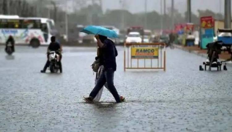
Weather Update: Monsoon turns northwest; Delhi, Uttar Pradesh, other states to see heavy rains - Check IMD’s forecast here
As per IMD, widespread rains with isolated heavy falls are possible over Rajasthan on Wednesday (July 27); Punjab, north Haryana and Chandigarh from Wednesday to Sunday (July 27-31), and Uttar Pradesh from Thursday to Sunday (July 28-31).
New Delhi: The India Meteorological Department (IMD) has predicted enhanced rainfall activity over Northwest India's plains till July 31. According to the IMD, widespread rains with isolated heavy falls, thunderstorms and lightning are possible over Rajasthan on Wednesday (July 27); Punjab, north Haryana and Chandigarh from Wednesday to Sunday (July 27-31), and Uttar Pradesh from Thursday to Sunday (July 28-31).
The weather department has also issued a yellow alert for Rajasthan for Wednesday, and over Uttarakhand, Himachal Pradesh, Punjab, Haryana, Chandigarh, Delhi and Uttar Pradesh until Sunday. The Met Office also informed that a fresh western disturbance by the Western Himalayan Region, and a cyclonic circulation situated over East Rajasthan and the neighbouring areas, following which IMD’s advisory level over Uttarakhand and Himachal Pradesh will be elevated to an orange alert on July 28 and 29.
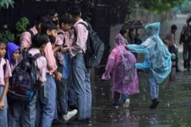
Rainfall activity in Delhi to pick up
Rainfall activity in Delhi is likely to pick up from today, with the MeT office forecasting moderate rain or thudershowers in the city over the next three days. According to IMD, the monsoon trough is likely to "continue to shift gradually northwards", leading to an increase in rainfall activity over north India from Wednesday.
Himachal to witness heavy rainfall
The Himachal Pradesh meteorological department on Wednesday said heavy rain is expected in the state over the next few days which may lead to disruption of essential services and trigger flash floods. The ongoing rainfall activity is very likely to increase from July 28 to 30. Moderate rainfall with isolated spells of heavy rainfall is likely in parts of Lahaul-Spiti and Kinnaur during the next 48 hours. Flash floods are feared in parts of the two districts during this period, it said.
Heavy rains batter rajasthan
A meteorological department official said, at present, there is a circulation system over eastern Rajasthan, which will have its effect in the districts of Ajmer, Jodhpur and Udaipur divisions for the next 48 hours. From July 28-29, there is a possibility of a gradual decrease in monsoon activities in some parts of the state, MeT centre director Radheyshyam Sharma said. The trains that were cancelled due to inundation of railway tracks were Jodhpur-Jaisalmer, Jaisalmer-Jodhpur, Jodhpur-Bhopal, Bhopal-Jodhpur, Jodhpur-Barmer, Jodhpur-Hisar and Hisar-Bikaner trains, a NWR spokesperson said.
Heavy rainfall likely in parts of Telangana
The IMD said heavy rainfall occurred at isolated places in Bhadradri-Kothagudem, Jangaon, Khammam and Ranga Reddy districts of Telangana. The Met centre said heavy rain is very likely to occur at isolated places in Bhadradri-Kothagudem, Suryapet and other districts on July 28. Light-to-moderate rain or thundershowers are very likely to occur at many places on July 28, it said in a release.
Northeast weather update
Widespread light to moderate rainfall with isolated heavy falls and thunderstorms or lightning is also expected over Sub-Himalayan West Bengal and Sikkim, Arunachal Pradesh, Assam, Meghalaya, Nagaland, Manipur, Mizoram and Tripura till July 31.